
File Upload
Choose Upload asset in the application header to open Add new asset. Upload processed capture data here: a mesh, tiled model, point cloud, Gaussian splat, or orthomosaic. The site doesn’t turn a folder of camera photographs into a reconstruction.
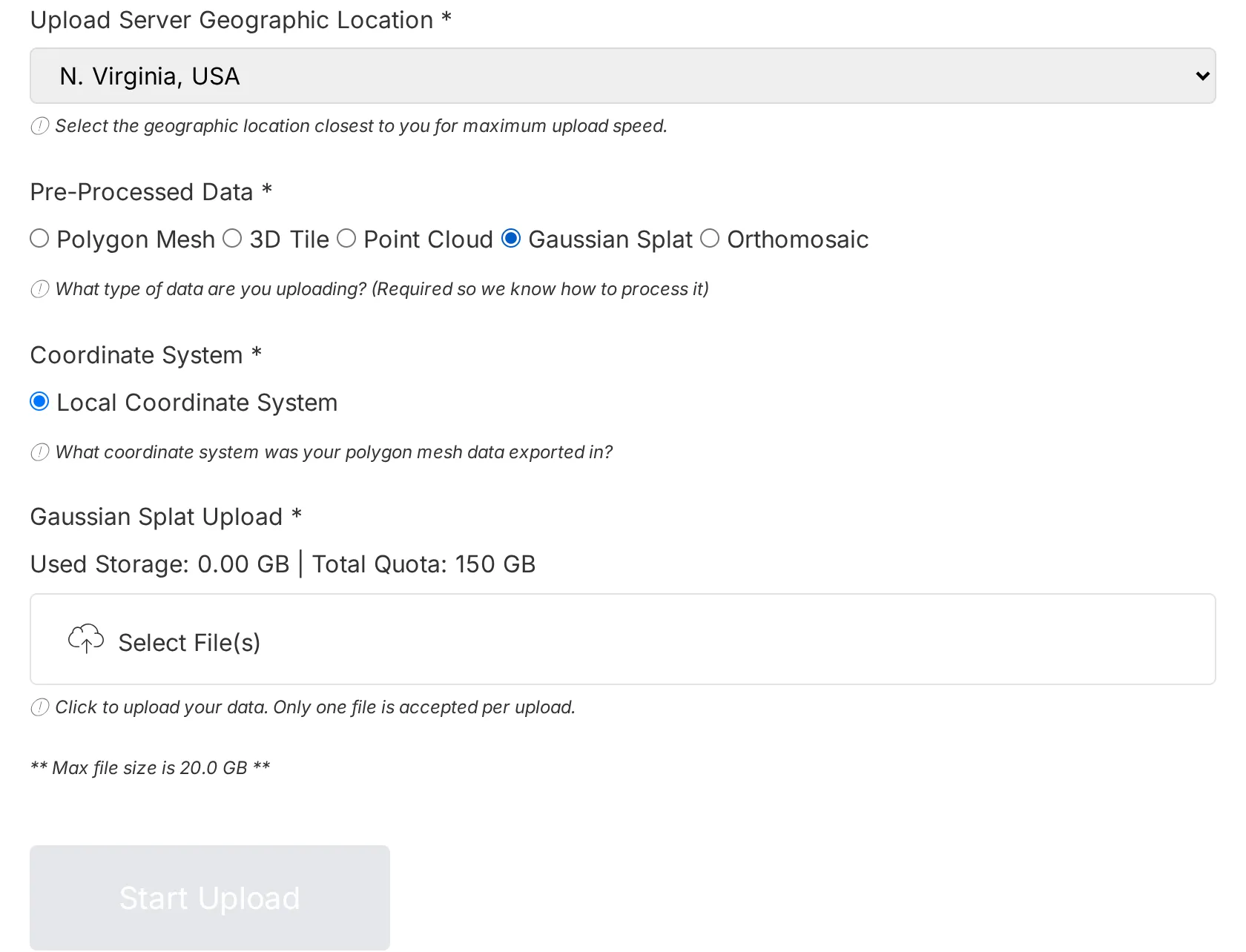
GW4 test account, September 2026. Storage usage and available servers depend on your account and current server availability.
1. Choose an upload server
Section titled “1. Choose an upload server”Wait for the upload server availability check to finish, then select a location offered by the form. GW4 currently lists Frankfurt, Germany, London, UK, and N. Virginia, USA. Choose a nearby available location; the list can change when a server is unavailable.
2. Select Pre-Processed Data
Section titled “2. Select Pre-Processed Data”The selected data type determines which files and coordinate systems the form accepts.
| Data type | Files accepted by the browser picker | Preparation |
|---|---|---|
| Polygon Mesh | GLB; ZIP, RAR, or 7Z | Package an OBJ with its MTL and texture files in one archive. A bare OBJ isn’t accepted by the picker. |
| 3D Tile | 3TZ; ZIP, RAR, or 7Z | Include the tileset JSON and the tile files it references. |
| Point Cloud | LAS, LAZ; ZIP, RAR, or 7Z | Keep any supporting files together in the archive. A bare E57 isn’t accepted by the picker. |
| Gaussian Splat | PLY, SPLAT, SPZ, KSPLAT, SOG; ZIP, RAR, or 7Z | Use a supported splat capture format. Keep the SOG extension on a SOG file. |
| Orthomosaic | TIF, TIFF; ZIP, RAR, or 7Z | Use a georeferenced TIFF with its coordinate information. |
A file extension alone doesn’t guarantee that processing will succeed. For example, a point-cloud PLY isn’t necessarily a Gaussian splat PLY. Unsupported file contents or format versions can fail during processing.
3. Select the coordinate system
Section titled “3. Select the coordinate system”- Polygon Mesh and Gaussian Splat: Local Coordinate System.
- 3D Tile and Point Cloud: Local Coordinate System or WGS84 (EPSG:4326).
- Orthomosaic: WGS84 (EPSG:4326).
Select the system your data actually uses. Choosing WGS84 doesn’t convert a file from another coordinate system. Position a local asset after processing with the Transform menu. See Getting Your Height Right for elevation references.
4. Select a file that fits your storage
Section titled “4. Select a file that fits your storage”Use Select File(s) and follow the form’s file selection instructions. Follow the Max file size shown below the file picker. The current GW4 Gaussian Splat form displays 20 GB; other forms can display a different limit. Your remaining account allowance can be smaller than the file limit. If a file exceeds the displayed limit, contact support before attempting the upload.
The form shows Used Storage and Total Quota. Quota includes your Account Plan and eligible Additional Storage. An upload is refused if its file size plus current usage exceeds the allowance. A failed subscription payment can also stop uploads; follow the payment notice if one appears.
Compress related source files together when the format requires it. Keep a local copy of your originals.
5. Start the upload and check processing
Section titled “5. Start the upload and check processing”Complete the required selections and choose Start Upload. Keep the browser tab open and your connection available while the file transfers. File transfer and processing are separate stages; a completed transfer doesn’t mean the asset is ready to view.
Open My assets from the avatar menu to check progress. Processing failures appear beside the asset, and the platform sends a success or failure email when processing completes. Processing time depends on the file, data type, and server queue; there isn’t a fixed completion time for each type.